


Il tuo carrello è vuoto!
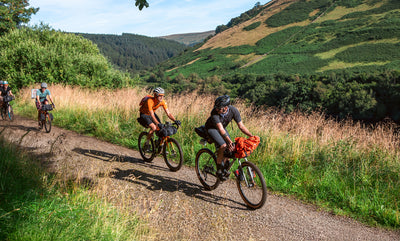
The Dales Trail
Adrian Wright has been creating bikepacking routes and events in our Yorkshire backyard for a number of years. His latest takes in a lap of the Yorkshire Dales National Park, and we are proud to be supporting it. In the lead up to the group start in September, we chatted to Adrian about his background and the new route, the Dales Trail. Those of you who have met the man will know that he likes a natter, so grab a brew and enjoy the back story.

Restrap: Who is Adrian Wright? What's your background?
AW: I've lived in Halifax, West Yorkshire, for 30 years and in that time I've gone from riding on the canal towpath to work as a Geography teacher at the local high school, to taking part in MTB races that used to happen in the three local valleys: the Calder, Colne and Holme. These rides inspired day trips to the Lakes to tackle Nan Bield and Helvellyn and, in the following years, take on the classic MTB coast-to-coast from St Bees Head to Robin Hoods Bay. My partner and I raised two boys, both of whom are now in their 20s, and in their early years we would visit trail centres in Wales. On family holidays we rode the Camel Trail (Cornwall) and travelled abroad to the Jura Mountains and Morzine. Like many others in more recent times I've taken to bikepacking and found myself at a Bear Bones 200 bash in 2022 as well as the HT550 in May 2023.

Restrap: The Dales Trail isn't your first route. What inspires you to plan them in the first place?
AW: A promise to a friend to ‘do a big ride’ and finding a new map of the British Isles lead me to my first route, the Calder Divide Trail. Will Norman was a good friend and part of a mountain bike group called ‘Bike Club’ that I'd been a member of for 15 years. Tragically, Will died in 2021 from cancer. We lost a riding buddy. His partner Liz lost a friend and a husband. Their two children lost a father.
Will joined Bike Club after his partner Liz approached me in the Big 6, a pub in my home town of Halifax, and asked if other riders could join the group. Liz was with her fell running group whilst Will was stuck at work so we compared trails and I took Will’s name and email. Later that week I got in touch with Will and we chatted about biking and our need to explore the outdoors. Will was a quiet, gentle bloke. 6 foot 2 and strong on his bike. He rode with Bike Club for 5 years but then suddenly he stopped coming. I assumed his school work was consuming all his time but then I ran into Liz in the local park and she told me that Will had pancreatic cancer. When I met up with Will for the last time he was with Liz and their two young children in the Piece Hall in Halifax. It was between the various Covid lock downs and everyone was out. On that day I was in a record/coffee shop called Loafers and Will was sitting outside with a coffee enjoying the sun. We got talking. Liz looked at Will and said “You need to tell him”. I knew what was coming next. Will laughed but Liz pressed on. “He doesn’t have much longer” she said. There wasn’t much we could say. So we just sat beneath the old sandstone columns and watched the children run around. Eventually I got up, shook his hands and said “Bike Club has been asking after you and we’ve kept your spot in the Big 6”. He smiled at hearing the news. I parted with a nod and the words “we’ll do a ride for you”. I didn’t see him again. His death at the age of 42 was a real blow to all of us.

The promise of ‘doing a ride’ stuck in my mind and by chance a few days later I saw a new map of the British Isles created by Robert Szucs. On this map of the British Isles every river basin is represented by a different colour and within each basin the thickness of the lines represent the volume of water. Szucs map opened my eyes to a trail in the Calder Valley where I lived that I hadn’t seen before. For many years I had explored parts of the watershed of the Calder. Szucs’ digital map helped me see the whole watershed of the River Calder that extends from the moors above Todmorden on the Lancashire/Yorkshire border down to Castleford where the River Calder meets the River Aire. Along the way the Calder is joined by six other rivers – the Cragg, Hebble, Ryburn, Colne, Holme and Spen – and covers just under 400 square miles.
So I set out to explore the network of bridleways, green lanes and singletrack that were there, on strips of common land, created by local people over the last 4,000 years, from the Pennine moors such as Flower Scar where the river gathers, on through steep sided wooded valleys such as Coxley, past the high ground of Thieveley Pike and under the white blades of numerous wind farms. I found that the trails connected into a circular route that traced the watershed of the River Calder. I called it the Calder Divide Trail.
Six months after Will had passed Liz got a real surprise when I turned up at her house with the Calder Divide idea. It threw her at first. She was busy raising two children. She had a full time job. But she was a fell runner and loved the hills just like Will did and inside 5 minutes we were recalling stories of Will and his bike adventures. She gave her blessing to the ‘big ride’ and the event and so I got on with the planning.

The moment I saw the outline of the Calder Divide Trail I also knew there was a much longer ride along the Yorkshire Divide that would encompass the wider Humber basin into which the 25 main rivers that have shaped Yorkshire flow. I have now mapped out the Headwaters Trail, a 320km circular route around the high ground of the River Calder, River Aire and River Don. There is also the 720km Source to Sea Trail which connects trails on the high ground where 10 rivers rise. Rivers such as the Swale, Ure, Nidd and Esk. I think this way of keeping a promise and seeing the rivers and the landscape they shape keeps the promise I made.
Restrap: It's one thing planning a route, it's another turning it into an event. Why is the event side so important to you too?
AW: Over the last four years I've planned 48 routes that range from the one day Mills n Moors to the multi day epic ride that is the Source to Sea Trail. That's a lot of plotting on 'Ride with GPS' to create gpx files and so what motivates me is the simplest of things: a trail you ride with others is something you'll remember, not all of it, but some part, some random thing out on the trail will become a story that you'll share with others.
An event is often about setting personal targets, putting a date on the calendar to get yourself outside and when everything comes together an event reminds you that riding bikes is fun. An event is about mixing with riders at the event hub and out on the trail, at gates, bridges, fords, and on steep climbs or on tricky descents you'll meet other riders and exchange a few words, pass a few minutes in the company of others. Such moments make us human.

In the beginning, on the Mills n Moors events, I rode with a social group that I set up. Since then the events have grown so I've taken more of a coordinating role back at the Event Hub. The hubs are usually local bike shops and we set the space out so riders can gather and chat inside the shop. So in basic terms I organise the events as they keep me grounded and help me connect with others. I know I've done my job right when I hear a rider say they never knew that track and they'll be back to try the longer route. This has happened at every event and I always experience a frisson of joy in sharing our native highways.
Restrap: What do you think makes the Dales Trail special, and what differentiates it from other bikepacking routes in the Dales?
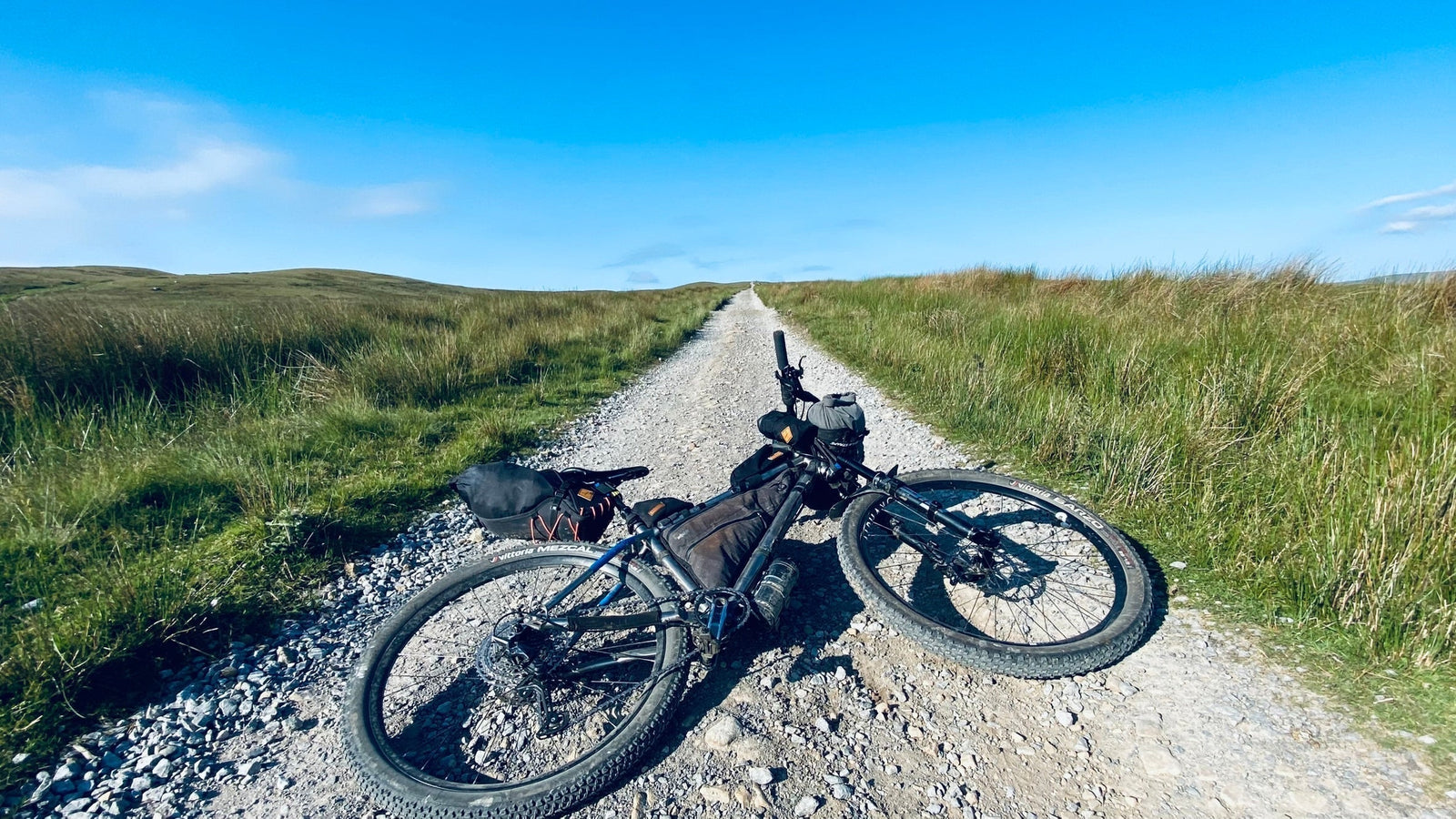
AW: The Dales Trail is special because it takes riders around the edge of the Yorkshire Dales National Park and the Nidderdale Area of Outstanding Natural Beauty and so a riders gets to experience an incredible diversity of places compressed into 335km from Tan Hill overlooking Stainmore Gap, Settle with our Event Hub, Fremington Edge above Reeth and the Howgills with its unique whale backed grass hills. In terms of landscapes this is Swaledale to the north, Malhamdale to the south, Nidderdale to the east and Cumbria to the west. Today the exact boundaries of the 'Yorkshire Dales' remain fluid. In the popular imagination the Yorkshire Dales centers on Swaledale, Wensleydale and Wharfedale but there are many other Dales with counts varying from 30 to over 50. To complicate matters the extension of the Yorkshire Dales National Park in 2016 took in areas of Cumbria, traditionally a region with a very separate identity to the Yorkshire Dales. The National Park now covers 2,179 square kilometers to which we can add Upper Nidderdale with another 600 sq. km.

The Dales Trail stands on its own as a multi day 'rough stuff' route worth experiencing. The route takes you across some of the Dales most remote and wild places such as the moorland track below Mossmire Hill that leads into Swaledale, a fine track through the oak and pine woods in Westy Bank above Bolton Abbey in Malhamdale, over Iron Hill in the shadow of Oddendale Stone Circle in Cumbria, a long winding track though Micklethwaite Gill in Wensleydale, as well as forgotten tracks that were once Drovers Roads such as Ocky Road at the head of Dentdale in Westmorland and across faint grassland tracks through the Stank in Wharfedale which is not half as bad as it sounds!
The route also connects outlying villages ignored by the other bikepacking routes in the Dales. We visit places such as Dent, Orton, Crosby Ravensworth and Carlton with its community owned pub. We also pass through market towns that other routes miss out such as Sedbergh and of course Settle with its main line railway and 3 Peaks Cycles where the starting line is located. The event hub had to be in Settle because of its transport links and its the home of the long running 3 Peaks Cycles. In basic terms I believe a bike event should support the local bike shop. The Dales Trail does that and so puts something back into the local economy, sustaining the cycling infrastructure that is so fragile at the moment.

Restrap: What are your highlights of the route?
AW: The Dales Trail was two years in the making but the landscape it takes in was 200 million years in the making with the earth's forces depositing, crushing, folding, rising and eroding the land over eons of time. There are numerous highlights.
Like the Dales Divide, the Pennine Bridleway and the Dales 300 we visit the iconic landscapes such as Ribblehead Viaduct, Dent's Houses on Apedale and the 14th Century curtain walls of Bolton Castle. But there are many more distinctive landscapes that the Dales Trail is unique in encompassing as it takes you through the borderlands of the Yorkshire Dales National Park.

We climb up to The Calf and descend Bowderdale on the longest continuous moorland singletrack in the north of England. We also descend the superb limestone bedrock on Stocksdale Lane in Malhamdale, Fremington Edge in Swaledale and of course the classic long flowing track on millstone grit from Tan Hill down to Keld. The 335km (210 mile) route takes you over Iron Hill, the last vantage point in the YDNP looking across to the Lake District Fells and there's a short but brutal 'hike a bike' out of Gunnerside and onto Reeth Moor with its 'Stone Crusher', one of the more remote Control Points used on the three day event.
---
The Dales Trail event will be held 6th - 8th September 2025. For more details and entry, visit www.yorkshiredivide.co.uk.